
Archive
Tag: coastal planning
Article
Open Access
(Geo)Design Coastal Cities: Design with Data (and Nature too)
by Ming-Chun Lee, José L.S. Gamez
pp. 337–366
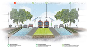
The geography of a coastal city, such as its native geological, biological, and physical conditions, plays an important role in understanding the impacts of climate change upon the area. To better identify strategies for adaption to global climate change, planners and designers need better tools and techniques to learn and analyze the geographical context of their cities on coastlines worldwide. This article describes an urban design studio conducted in the spring of 2014. Students in this class explored the future of North Carolina coastal cities in light of rising global sea level. Geodesign using GIS and other visualization tools enabled the students to focus on urban morphology, development patterns, and environmental characteristics of the city in order to identify new interventions that can support a new set of relationships between urbanity and nature.