
Architecture and Intermodality. Guidelines for the Architecture of the Intermodal Hub at the FVG Airport Ronchi dei Legionari
ABSTRACT - The research addresses the topic of intermodality in terms of technical, typological, and architectural response of infrastructure systems, considering their relationship with the territory and the landscape. The study starts from the hypothesis of the development of a comprehensive intermodal hub in the Ronchi dei Legionari Airport (Friuli-Venezia Giulia, Trieste, Italy), integrated with the network of local public transport and railway infrastructure, considered in a scenario of sustainability over the medium term and updated with respect to the current economic situation. The first phase of the research focused on the definition of the guidelines for the design of the intermodal hub. Subsequently, the study verified the hypothesis by modeling some alternative scenarios, whose results led to the identification of a highly comprehensive set of data, consistent with the financial framework. Lastly, urban verification: the identified scenarios constitute a framework of alternative options corresponding to the minimum, optimal and critical conditions of the system as a whole. The possible alternatives prove the degree of versatility of the proposed layout which provides, as a whole, the possibility of opting for one of the proposed scenarios or for a more complex combination of the proposed solutions.
The development of an “application” model of sustainable intermodality at different levels, local and regional. Complete and coherent under different profiles: architectural, urban and territorial, infrastructural, economic, managerial and organizational. It is the final outcome of the operational research that has led, through a two-year commitment, to the definition of the guidelines necessary for the architectural configuration of the Intermodal Hub annexed to the FVG Ronchi dei Legionari Airport.
The research, the results of which have been widely recognized at the national and international level, has proved to be fundamental for the development of the final design of the Hub and therefore for the subsequent implementation phases. The term “operational,” in this experience, applies to the influence and the direct impact of a process of knowledge and formulation of the project, divided into analytical, interpretative and technical verification phases, avoiding any insistence and/or entrenchment in the definition of abstract models, or in self-serving logic.
The study of the material context and the territorial systems, with particular reference to urban, landscape, environmental, hydro geological and airfield statutory constraints was followed by analysis of the infrastructure system and the main connected networks. The study of flows and relations with the different territorial dynamics affected by the Intermodal Hub. The assessment of costs and benefits attributable to the more relevant modality model, the definition and comparison of alternative layouts. The dimensioning of a functional executive program in relation to policy orientations aimed at forecasting the development of the FVG Airport in terms of growth of flows and extension of the user base as well as the confirmation of the same in its role of strategic infrastructure for the regional context.
Hence, the technical and regulatory pre-dimensioning of areas, structures, roads, car parks, technological artifacts, open spaces and formal devices. The feasibility assessments and performance verifications related to the capacity and service level of the infrastructure and annexed elements.
The simulation, or simulations, related to the architectural configuration of the parts and the elements constituting the complex whole. A second phase concerned the updating of the analyses and the territorial frame of reference as well as the configuration of transformation scenarios, in the medium and long-term: Reversible minimum scenario, Optimal scenario or Standard Service Level and Crisis Scenario with the identification of the maximum sustainability potential of the infrastructure.
The definition of the guidelines, in essence the creation of the “rules of the game,” was not, as it might seem looking at the chronological listing of the various phases, an arid and exhausting crossing of data with a reductionist logic, but rather the attempt to address the complexity and the importance of a topic that is multifaceted and rich in implications such as an infrastructure, and more generally the theoretical and experimental steps concerning the architectural and landscape design connected to such infrastructure, by testing tools and techniques, disciplines and economies, fields of study, practices, and even testing the authors, who are of different ages and have different skill sets, in a truly multi-disciplinary action.
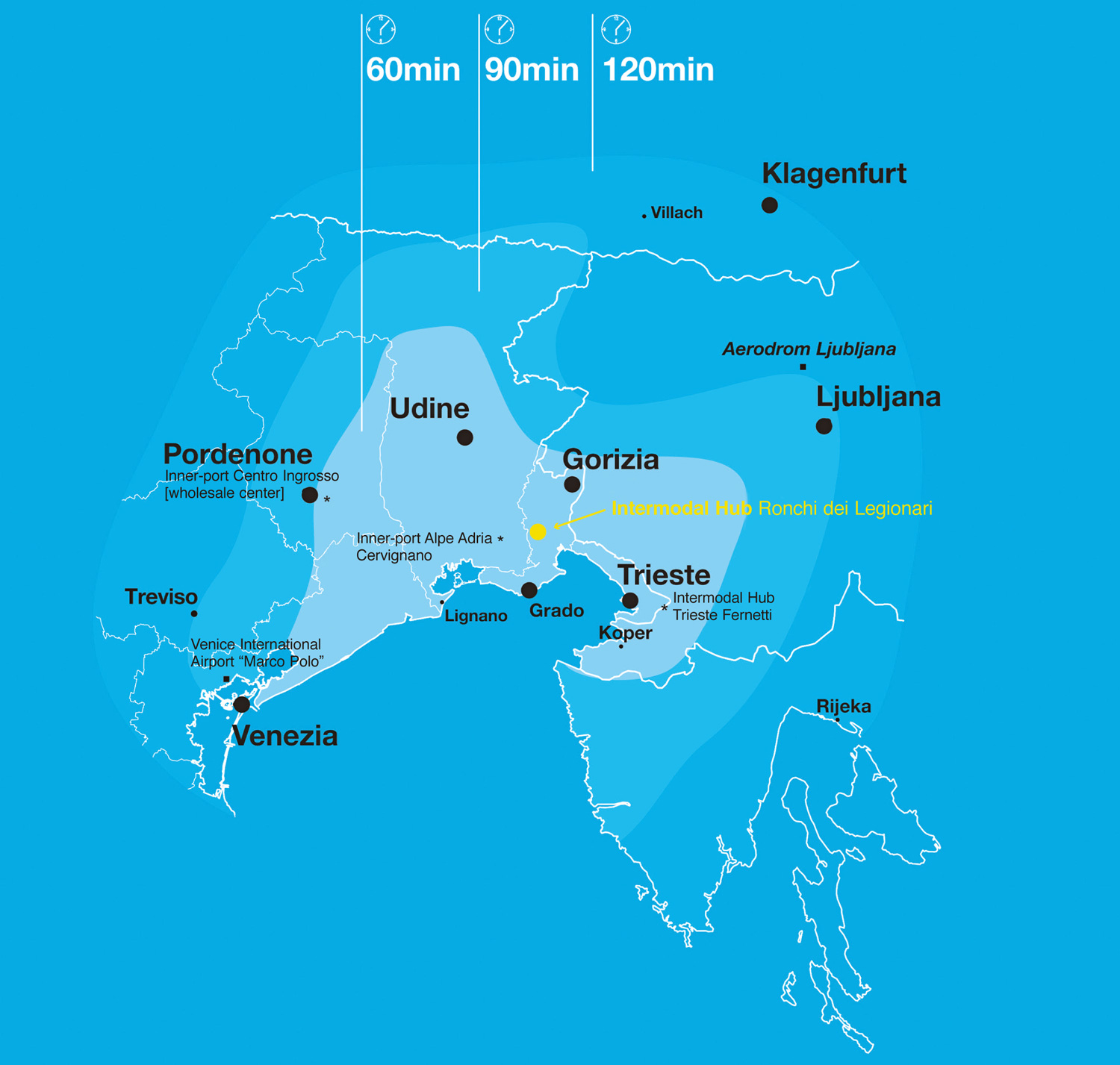
An action that, with different technical approaches and expressions, leads to a synthesis of the study, reflection and exploration phases, and to a method that illustrates the entire scope of the project and that can be understood, interpreted and revisited. This value of general applicability represents a major academic achievement of this research, and it represents and constitutes a high expression of design capability.
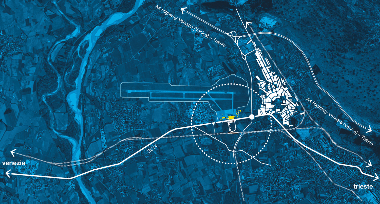
Research Program
The research includes the examination of the intermodality topic in terms of technical, typological and architectural response of the infrastructure systems, considering their relationship with the territory and the landscape.
Specifically related to the operational dimension, the research starts from the acquisition of a model of international scope comparable to the size, traffic flow and complexity of the regional airport of Ronchi dei Legionari, considered together with the annexed area as an object of study and a privileged field for experimentation and synthesis.
Divided into steps, the research leads to the definition of guidelines useful for the design of the intermodal exchange centre and the airport complex, with a high conceptual and qualitative profile, and to the configuration of an appropriate economic and functional feasibility, also considering sustainability aspects and environmental balance implications.
Hypothesis of the Study
The research has started from the hypothesis of the development of an intermodal hub connected to the Ronchi dei Legionari airport and integrated with the local road and rail public transport infrastructure, with reflections at the international level. The whole project has been considered within a broader sustainability framework of the interventions in the medium term, updated to the current economic situation.
In particular, the intention has been to explore the study of the intermodal hub in depth starting from a given functional programme, as a defined architectural and infrastructural organism, subsequently broadening the investigation to the possible urban articulations of the connected surrounding areas.
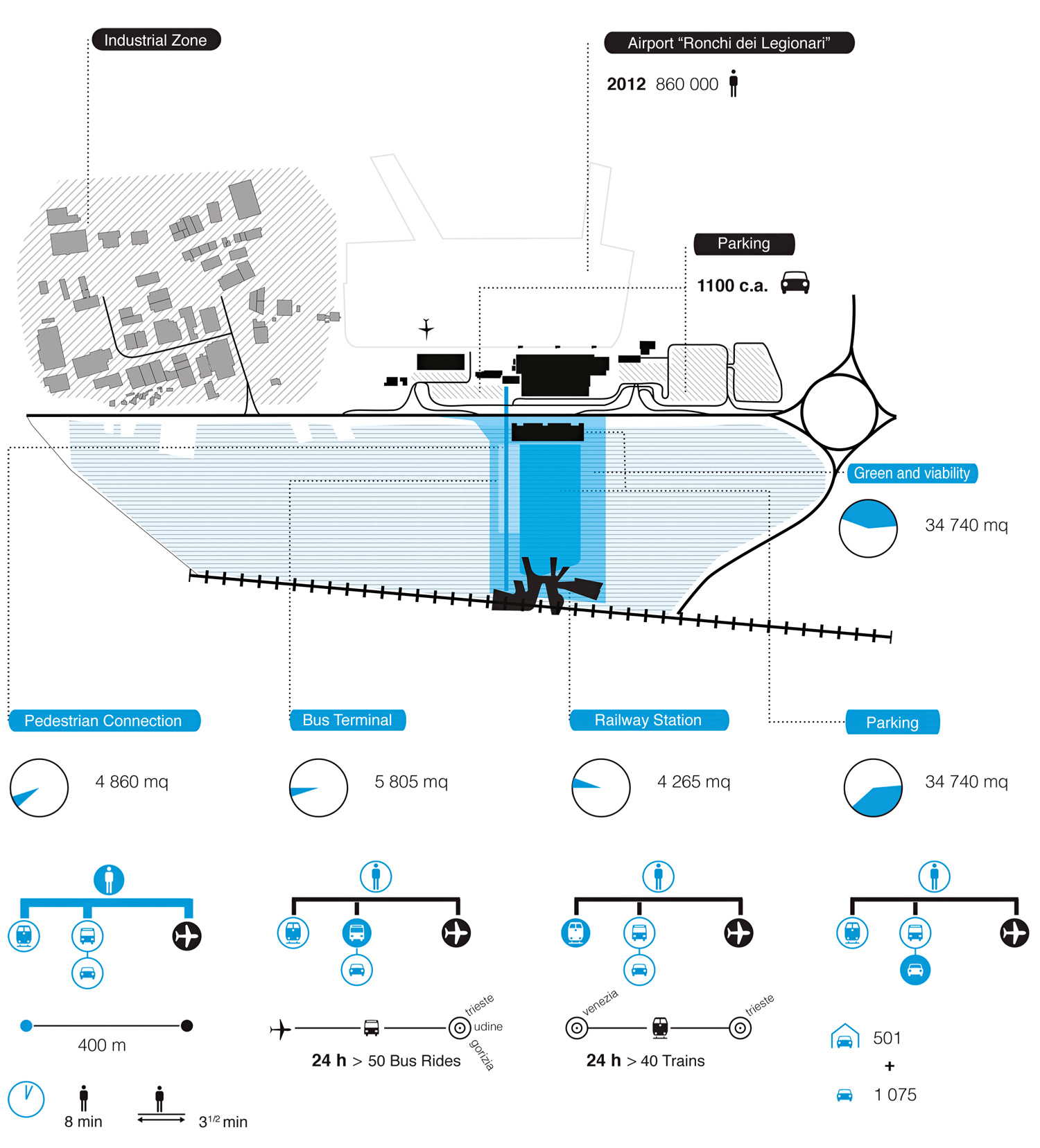
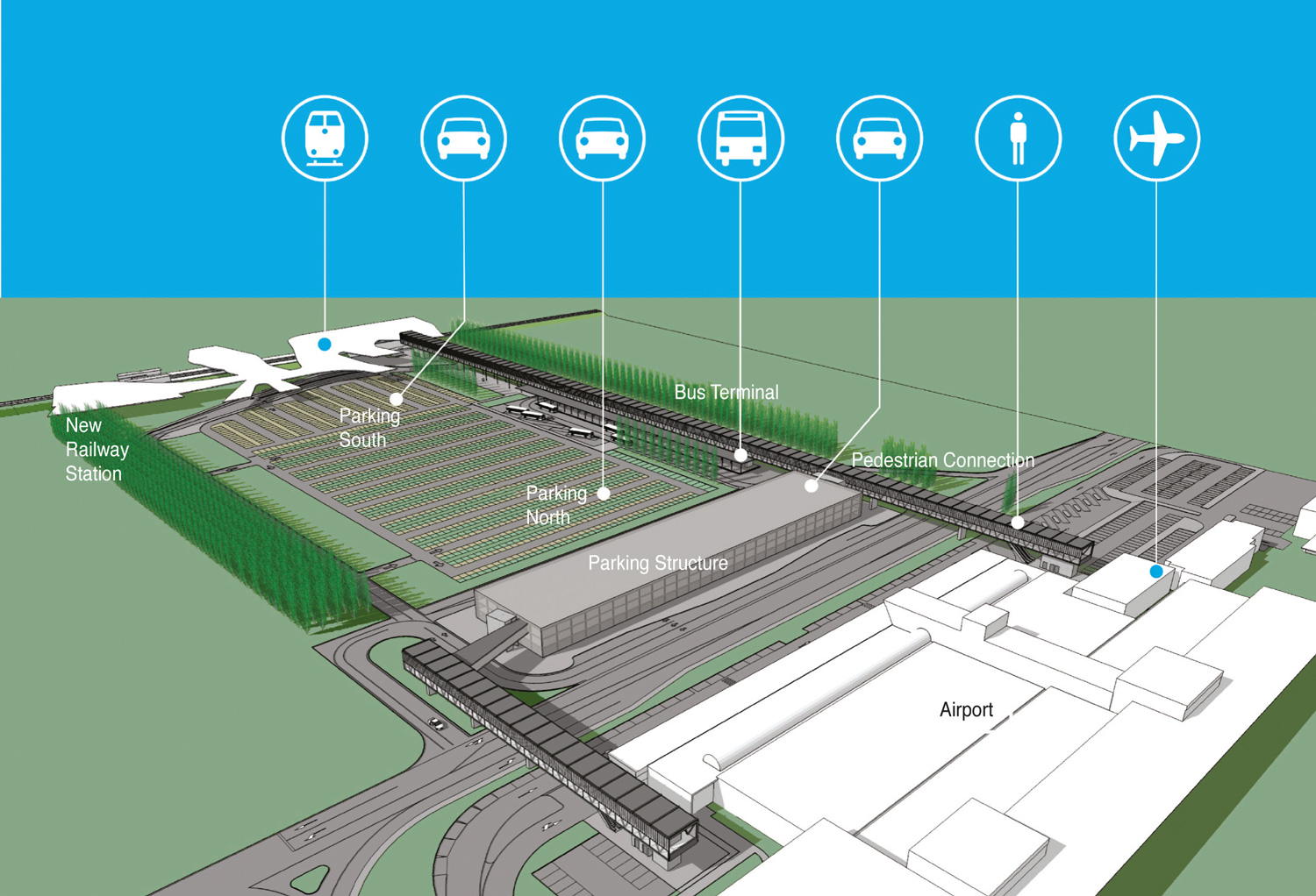
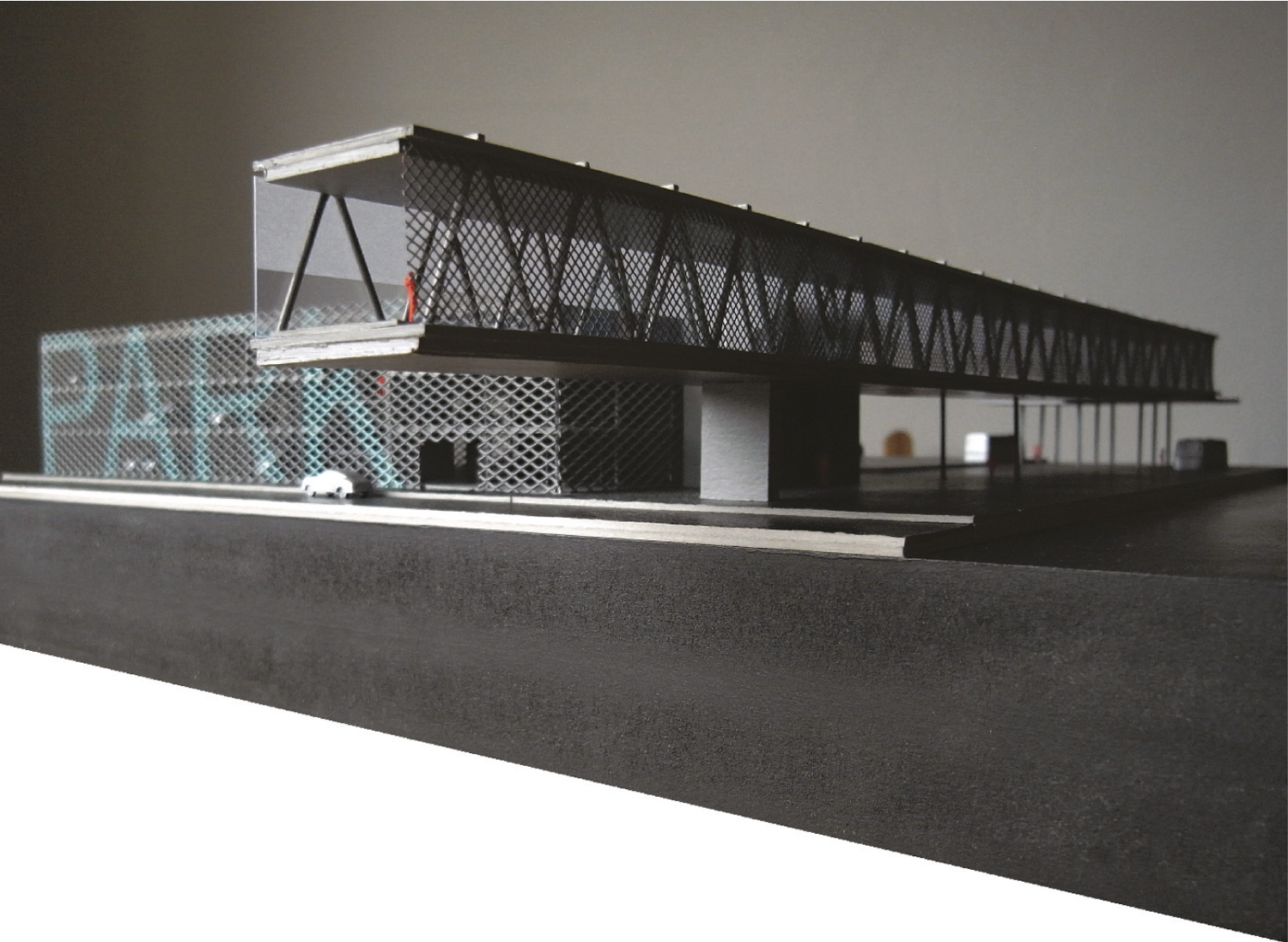
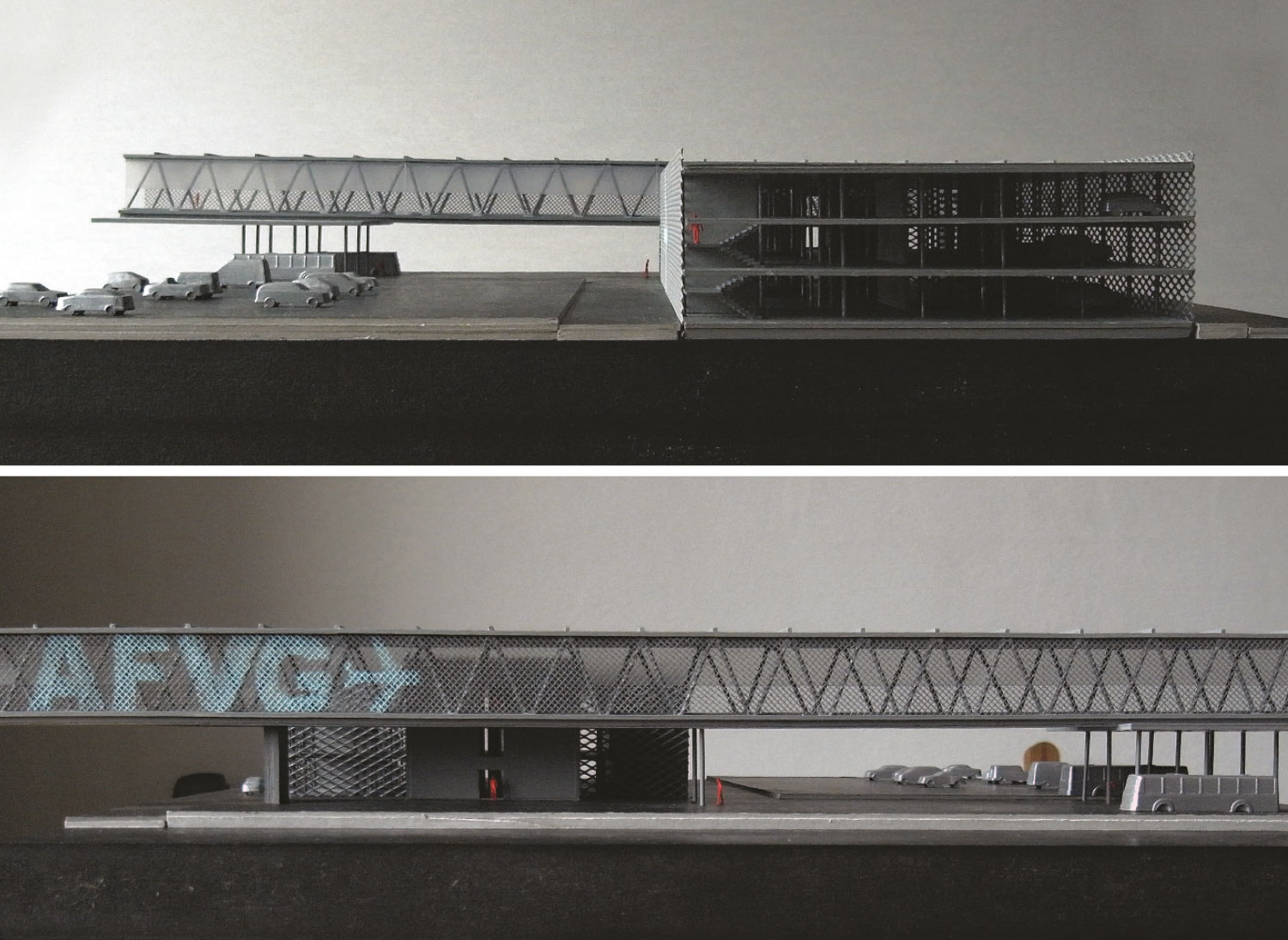
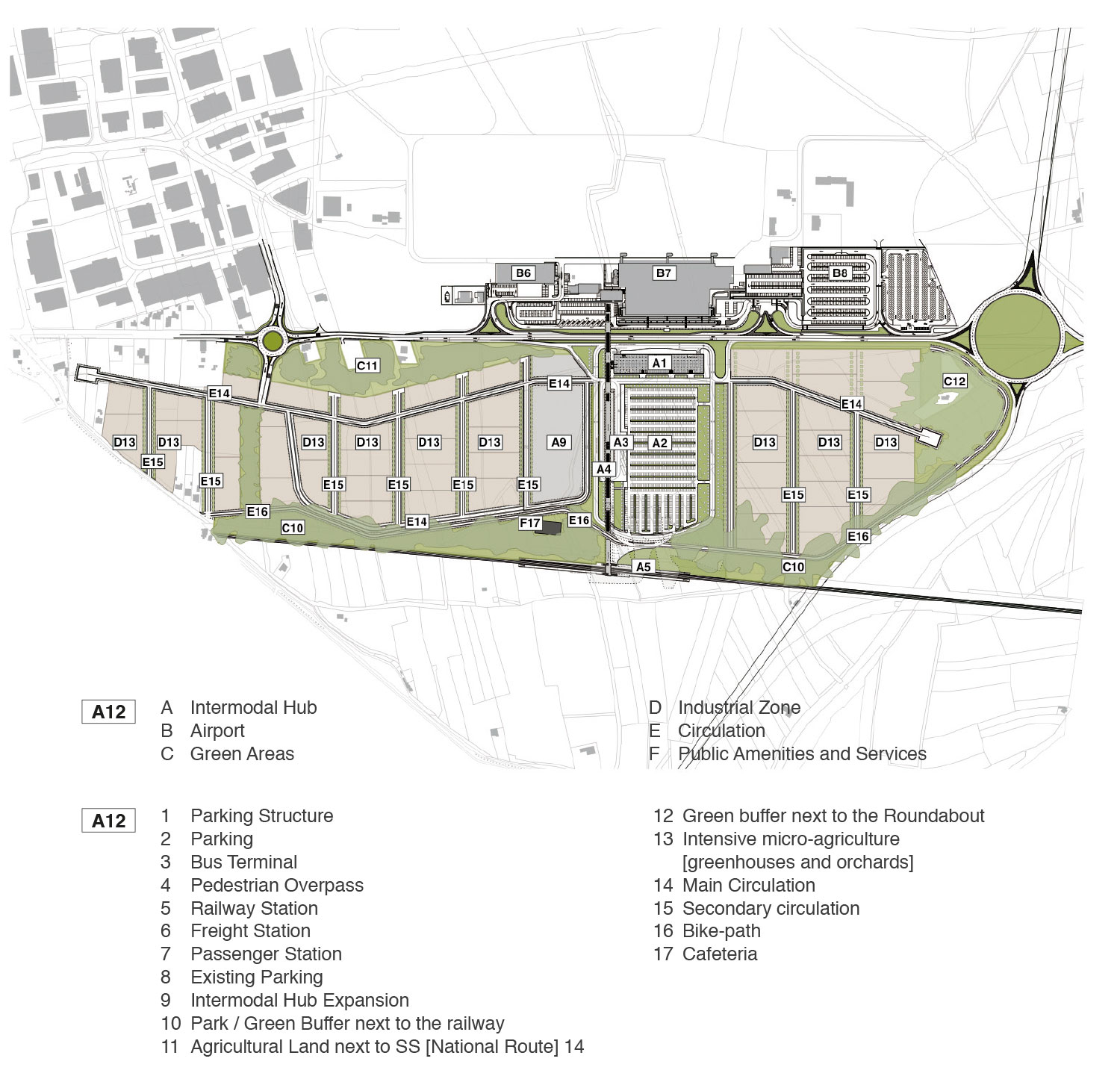
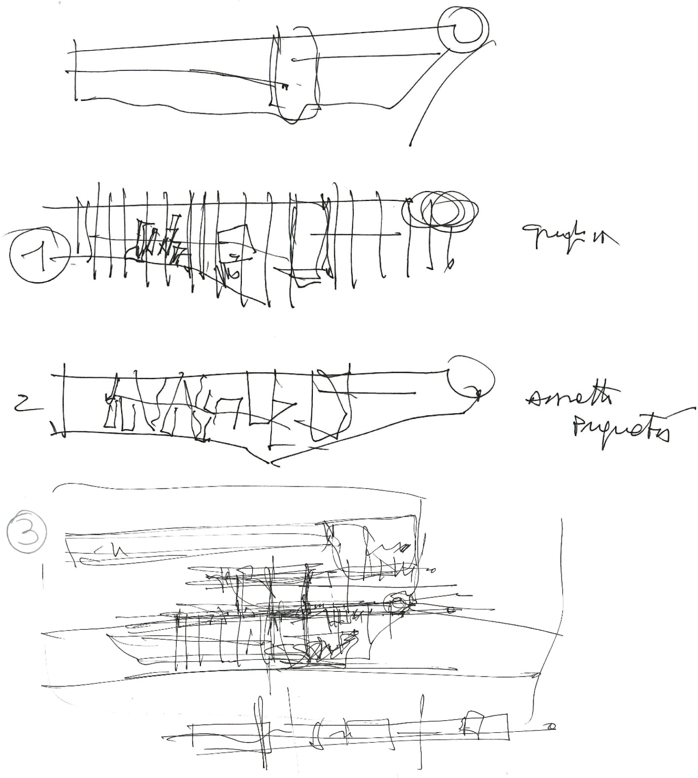
The main connection axis was identified in the elevated canopy that is connected with the various functions of the Intermodal Hub, integrating certain functions of individual parts in order to decrease the number of functional elements, to optimize the necessary economic resources and strengthen the identity of the architectural setting. In particular, in the railway station the canopy becomes the overpass of the tracks and in the bus station it becomes the roofing of the lower space. In this way, only a few other elements are necessary for the definition of the spaces, with obvious scale benefits.
Methodology Used
The general methodology used to develop the project hypotheses provides for two distinct types of activities: The first is the analysis of the context, carried out based on the various aspects being considered relevant or distinctive; the second phase assumes that this analysis is then verified by constructing scenarios aimed at providing alternative solutions to the contextual framework previously defined. In the study, these alternative scenarios have been compared to each other in order to determine the optimal solution and define the guidelines for the object of the research.
In particular, this methodology has been applied at different levels, urban and architectural, in order to take into account both the overall arrangement of the hub and the most relevant and sensitive architectural solutions.
Analyses Conducted
Urban context: a screening of the existing planning instruments at the different territorial levels has been conducted in order to acquire an overall picture of the local and territorial planning concerning the object of the study, aimed at determining compatible scenarios.
Restrictions: The study has identified the restrictions in the area from different points of view, and in particular regarding infrastructure, environment and landscape, in order to determine the “invariant” aspects for the comparison of different scenarios.
Infrastructural context: also with regard to the planning framework, the infrastructural context of the study has been determined in order to create a coherent whole, aimed at the proper inclusion of new flows arising from the verification scenarios.
Economic context and financial planning: the identified scenarios have been verified with particular attention to the economic and financial aspects, in particular, the short-term feasibility of the Intermodal Hub facilities.
Verification
The verification of the hypotheses made by the study was carried out by modeling some alternative scenarios, at the urban and architectural level. The comparisons and verifications of different levels have led to different applications of the described study methodology.
Depending on the degree of detail reached, in particular regarding the architectural level and in relation to the Intermodal Hub, it has been possible to identify a more defined and detailed scenario, coherent with the data framework, in particular with financial data. This has allowed us to recognize, among the evaluated alternatives, a single proposal as the solution to be favored.
Subsequently, we proceeded with the urban verification; the overall scenarios identified at this level provide a set of alternative options, defined by the degree of compatibility with the Intermodal Hub solution described above and taken as the invariant element for this broader hypothesis.
Definition of Alternative Scenarios
For the Intermodal Hub, characterized by a unified functional program defined in agreement with the airport, the hypotheses produced by the study investigated the different spatial and infrastructural configurations that were compatible with the analysis frameworks and suited to minimize the impacts and costs of the works.
Consequently, the study defined different characterizations for the surrounding area that are compatible with three different regimes and intensity of use of the Hub: a minimal condition, an optimal condition and a crisis of the system as a whole.
Identification of the Optimal Solution
The optimal configuration of the Intermodal Hub has been first identified through an assessment of the various structures, using a parametric quantification of the interventions, then through a detailed analysis of the identified solution with particular reference to construction costs.
The surrounding urban structure was assessed in relation to the infrastructural capacity of the Hub, verifying the possibility of developing the surrounding areas with limited adaptations of the Hub itself and the bordering road networks.
To this end, the limit assumed was an infrastructural configuration of the Hub that would not require major works on the bordering national and provincial roads.
Achieved Results
The achieved results demonstrate the technical and economic feasibility of a first development phase of the Intermodal Hub in the short and medium term, compatible with the analytical frameworks evaluated.
Subsequent scenarios of urban development also confirm the possibility to build on this first element in a sustainable and effective way, without the need to intervene in the existing road system. The possible alternatives that have been identified also demonstrate the degree of versatility of the proposed configuration, which provides the possibility, as a whole and both in the medium and long-term, to opt for one of the proposed scenarios or for a more complex configuration resulting from a structured combination of the solutions offered.
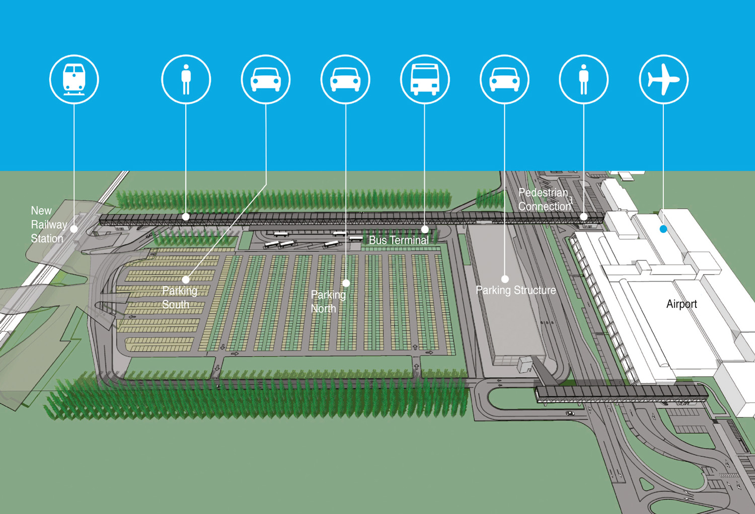
1. MINIMUM REVERSIBLE SCENARIO
This hypothesis should be viewed considering the national geopolitical scenario, the regional economy and the local urban settlement. The proposed layout provides for a minimal reorganization of the area with a different use of agricultural lands, characterized by a low environmental impact and reduced use of resources for infrastructural works. The agrarian vocation of the area is confirmed, with experimentations in specialized sectors such as intensive micro-agriculture, bio-agriculture or multifunctional agriculture (as called for by the recent feasibility study for the “Experimental Landscape Plan of the Province of Gorizia”), while waiting for a reversal of the declining trend of the regional economic scenario and the local production. The scenario explores a possible development of the East and West Sectors in line with the theory of “de-growth.”
All infrastructure and urbanization interventions have a reversible nature. The scenario provides for a road system with a backbone that makes use of the ring road of the Intermodal Hub.
The service level of the Sectors is guaranteed and integrated by the service level of the Intermodal Hub that, in relation to the trend of the flows related to the Airport and those planned from the new RFI stop and the CIMR bus line, offers a wide margin of functionality.
The scenario envisions an internal operation of the Sectors (urban and infrastructural) that exploits the time needed for the full operation of the Intermodal Hub (the estimate is at least 5 years). This, therefore, is a short-term scenario, but it does not necessarily constitute a preparatory phase for future transformations.
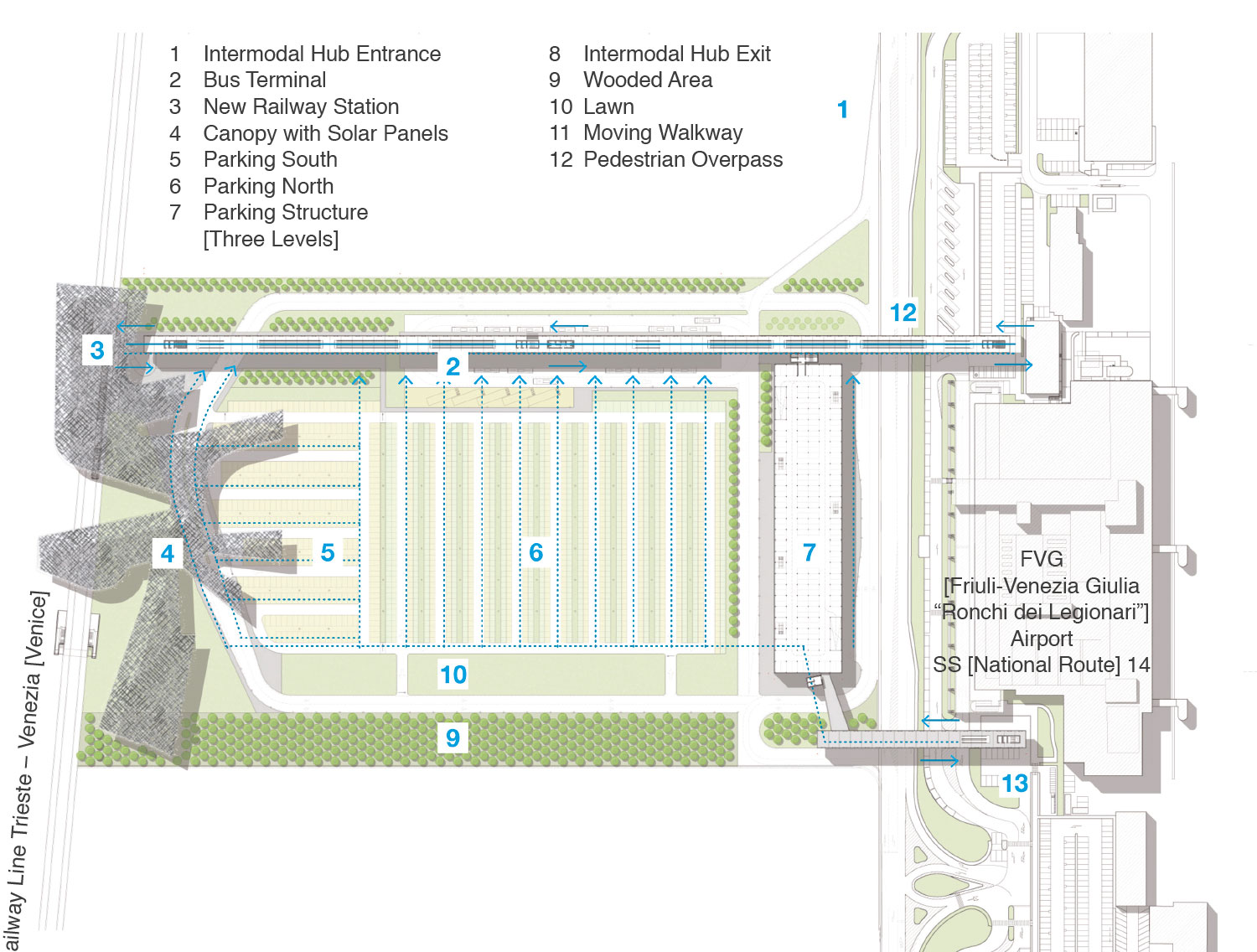
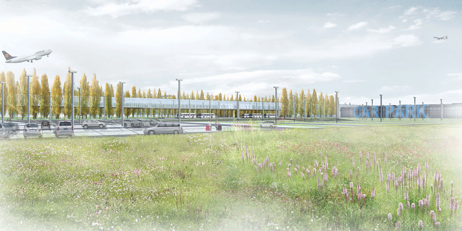
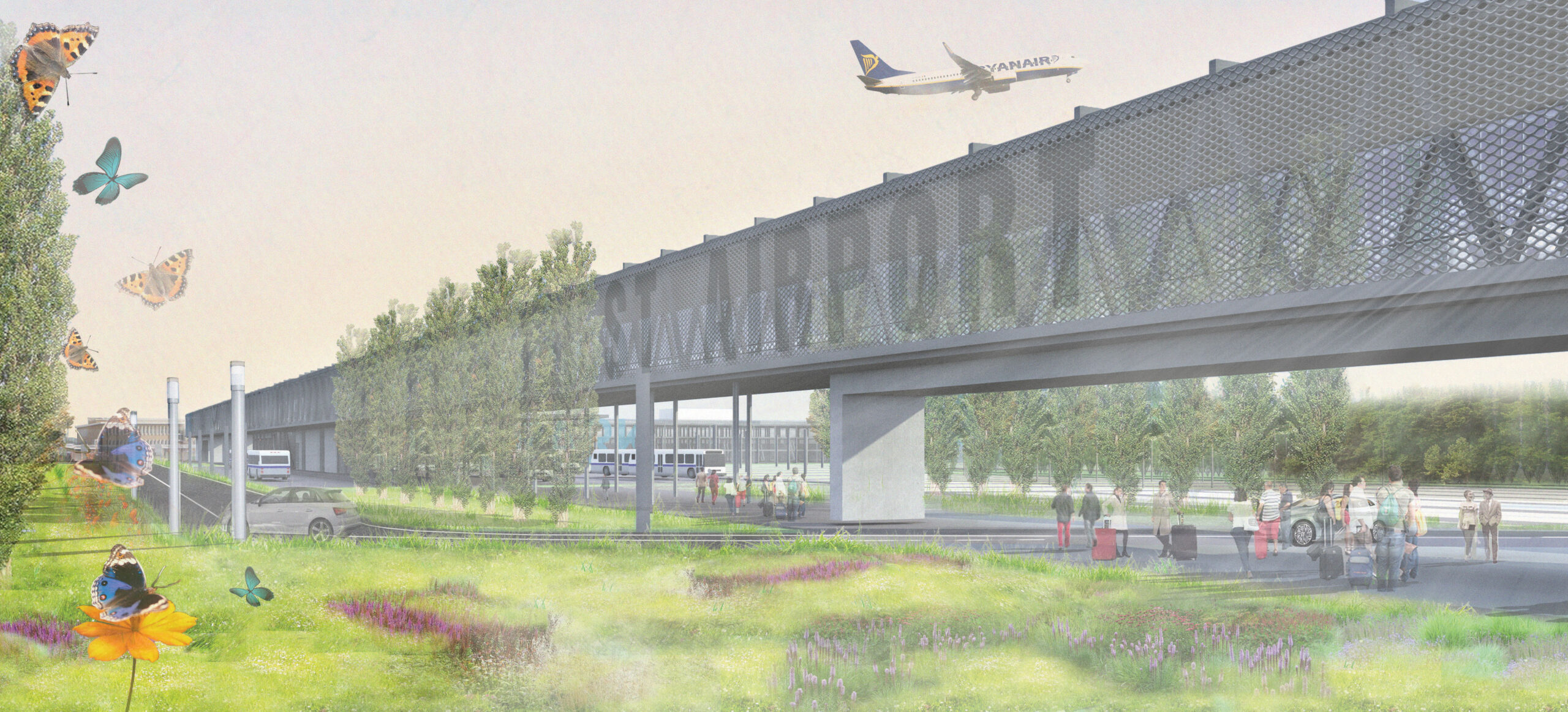
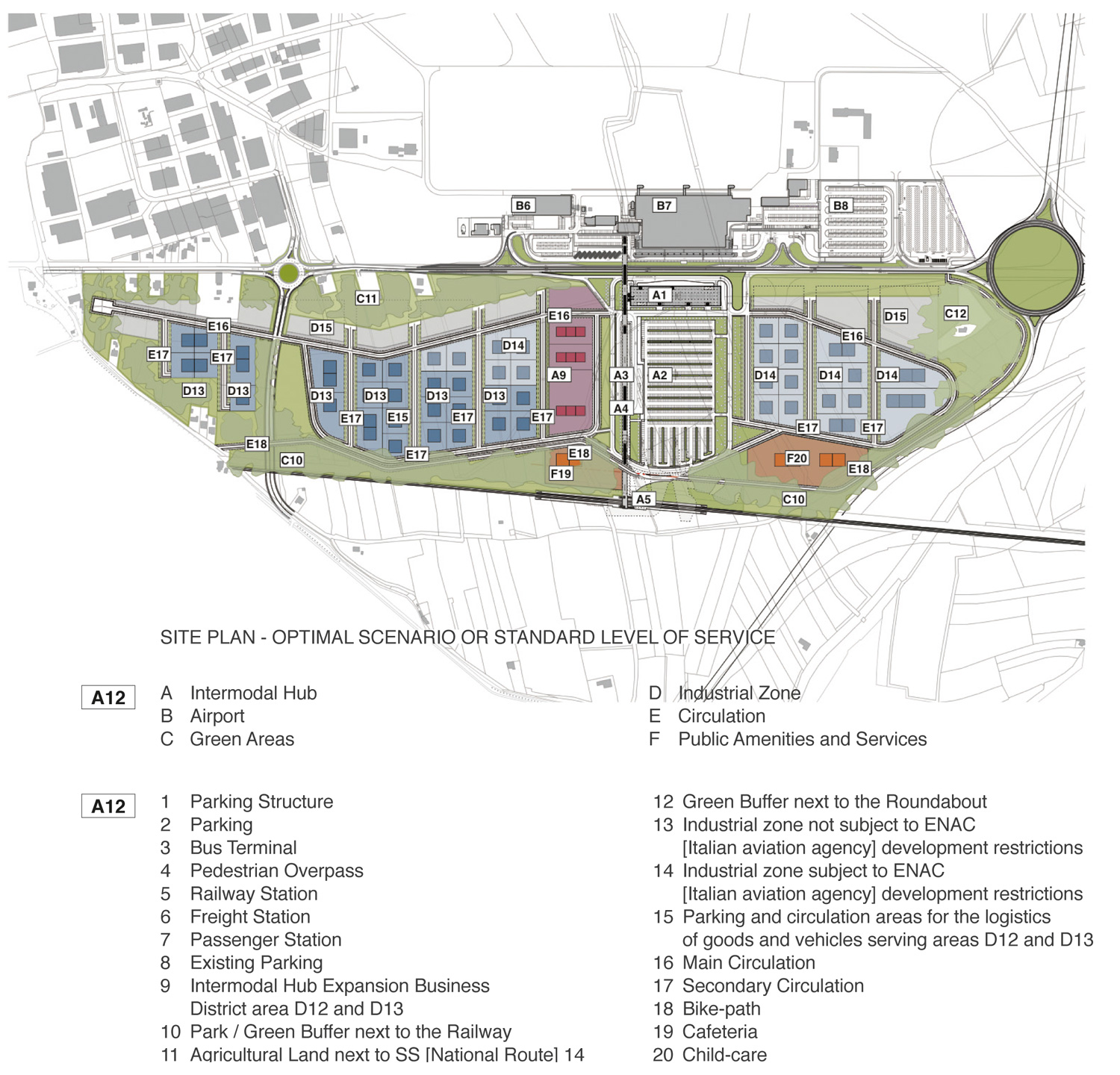
2. OPTIMAL SCENARIO OR STANDARD SERVICE LEVEL
This hypothesis assumes a scenario of national and European geopolitical growth and a regional framework of rationalization of production activities and urban reorganization carried out by local administrations (provinces and municipalities). Regional Law 5/2007, as amended, provides for several administrative cooperation instruments, including the integrated management of municipal production areas with a perspective of land use optimization. Starting from these assumptions, the Sectors create a substantial, comprehensive and well-equipped manufacturing/production area, with a strong environmental character (APEA), fuelled by the new “regional environment exchange platform” in service of all municipalities in the District. The hypothesis is based on the equalized transfer of “D” areas of the 9 municipalities of the District to Sectors adjacent to the Intermodal Hub, with the related transfer and compensation of expenses. In this way, the Sectors would be configured as a production district with a strong critical mass, a high level of specialization/experimentation and a wide range of spaces, infrastructure and equipment, and above all with access to major networks and logistics routes. The structural elements (invariants), in addition to the road system, will consist of the environmental system, which will characterize the ecologically equipped production area. The scenario offers an “ideal” level of service (TGM 2600/2800) as it leverages the full implementation of the Hub and increases its capacity with the addition of a dedicated ring on the side of the ring of the Intermodal Hub. The two Sectors will be structured in two rings connected to the middle one, enlarged, of the Intermodal Hub, and a widespread grid system, within the rings, which will organize the layout of the settlement model.
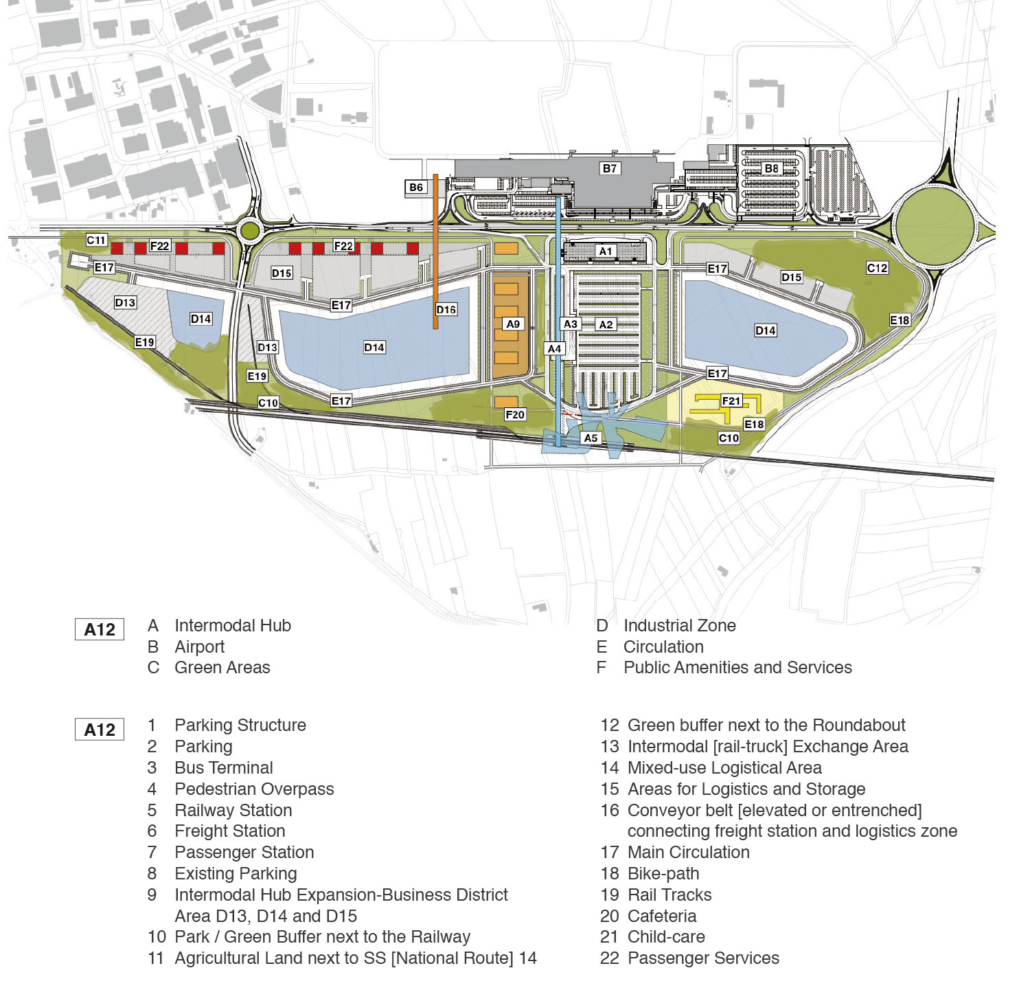
3. CRISIS SCENARIO AND IDENTIFICATION OF THE MAXIMUM SUSTAINABLE SERVICE LEVEL
4. GENERAL CONCLUSIONS
At the conclusion of the three simulations, the study has found some characteristics and functional vocations in certain areas within the Sectors that undoubtedly can be defined as the invariants of the project. These are constituted by the filter areas on the perimeters of the Sectors, along the SS14 and along the Trieste-Venice railway line; the public green areas that structure the urban layout and the different settlement hypotheses; the main road system with “tangent rings” around the main ring of the Intermodal Hub; the general urban layout that identifies the Intermodal Hub as the centre of gravity of all possible solutions for development of the East and West Sectors.
By contrast, it is possible to identify the system variables, mainly constituted by the areas that constitute the “heart” of the use foreseen for each scenario. It is believed that this aspect is important for the “success” of the proposed urban configurations, since it provides a considerable degree of freedom to the business initiatives and needs envisaged for each Sector. This high level of customization of the settlement model and the technical and productive organization will potentially boost the demand for settlement in the Sectors, if accompanied by incentives related to interventions that focus on rational land use, environmental quality and landscape qualification.
Awards
This essay was awarded Honorable Mention at the 2015 THE PLAN Best Paper Award contest. – Ed.
Acknowledgments
-
This article is a result of a research activity carried out between September 2012 and January 2014 under an agreement between the University of Trieste, Department of Engineering and Architecture, and Aeroporto FVG S.p.A. of Ronchi dei Legionari on 10 May 2012.
Notes
-
The project of the Intermodal Hub of Ronchi dei Legionari was chosen as a finalist for the GLOBAL AIR RAIL AWARDS in Oslo in 2014 and in Toronto in 2015. Selected by an international panel of qualified experts in the field, it was one of the finalists for two of the nine categories of the event: Concept of the Year and Project of the Year, obtaining the second place in the final ranking. The Global Air Rail Awards reward the design and implementation of the best airport intermodal facilities in the world. The jury expressed its appreciation for the medium and long-term vision of the entire project, thanks to which “it will be possible to achieve positive results, both from the logistical and the environmental. Standpoints. Exploring in depth the strategic vision of the intervention, the project has highlighted its landscape characteristics and the definition of evolutionary scenarios that, offering a broad spectrum of potential uses of the adjacent sectors, will be able to adapt to different future economic conditions.”